VÖGELE Get the Job Done Accurate to the Millimetre
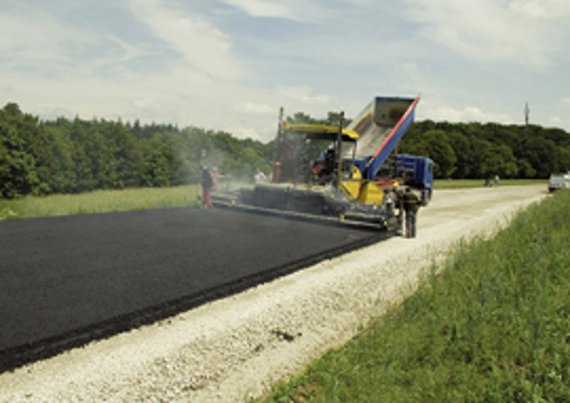
The 1.2km section of the new roadway with several tight bends serves to by-pass the village of St. Leon-Rot near Heidelberg, Germany, thus relieving it of heavy traffic. To the community of golf players, the small town is well known for its golf club which hosted the “Deutsche Bank / SAP Open” from 1999 to 2002 and repeatedly was a venue for the European Golf Championship.
Importing digital design data instead of tensioning reference wire
For construction of this new roadway, the use of NAVITRONIC® Plus suggested itself as an ideal solution. Here, as often with new construction contracts, design data was already available in digital form. The VÖGELE system for 3D machine control could import this data. As a result, there was no need to carry out time consuming surveying and preparation of the job site as would be necessary for grade and slope control with tensioned wires. This way, overall costs incurred for the project could be cut considerably.
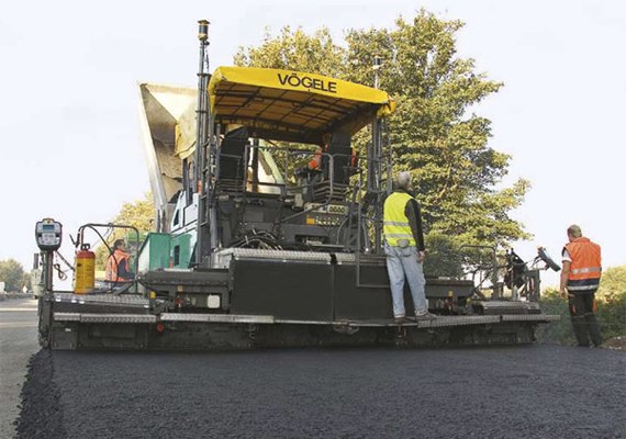
The SUPER 1900-2 works within the tight millimetre range
| For placing base course, a SUPER 1900-2 with AB 600 Extending Screed in TV version moved onto the job site. The screed was built up with bolt-on extensions to a pave width of 9m and the machine equipped with NAVITRONIC® Plus, the VÖGELE System for Automated Grade and Slope Control and Navigation. To the open interface of the VÖGELE unit for 3D machine control, the paving team had connected a mmGPS positioning system made by TopCon, which combines satellite-based and laser-based measurements. For determining the machine’s position, the TopCon unit uses a receiver able to lock on to signals of both the American GPS satellites and the Russian GLONASS satellites. This ensures that a sufficient number of satellites is in view at all times. As, however, satellite-based systems still cannot achieve more than an accuracy within the centimetre range, the TopCon mmGPS unit uses an additional laser receiver to obtain extra information for the elevation. Based on this combination of satellite-based and laser-based measurements, the machine’s location can be calculated with the high millimetre accuracy demanded for road construction contracts. Information from both sources is processed by the TopCon positioning system and a comparison made with the route’s specified design data. The results are transmitted from the TopCon system’s computer to VÖGELE NAVITRONIC® Plus. |
|
 |
NAVITRONIC® Plus for fully automatic control
At this point, the VÖGELE NAVITRONIC® Plus system takes over the control of the machine. In the event of deviations from specified data in terms of grade or slope, signals are emitted to NIVELTRONIC® Plus and corrections initiated automatically. Minor deviations in terms of screed position are corrected by way of the screed’s extending units. In the event of major deviations or the turning of radii, NAVITRONIC® Plus intervenes in the paver’s steering, thus locating both tractor and screed in compliance with the specified course of the route. It is fully automatic control of both the screed’s position and the paver’s direction of motion that makes VÖGELE NAVITRONIC® Plus unique in the market.
Even tight bends and changing crossfall pose no problem
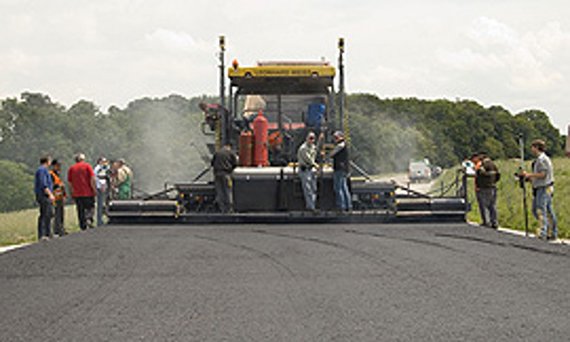
With the SUPER 1900-2, the bypass between 7.6m and 7.8m wide could be paved in full-road width. Due to the large width, a receiver was fitted to each of the screed’s arms to pick up the position as well as grade and slope. A special challenge on this job were the tight bends with radii of no more than just 400m and the varying crossfall with slope angles up to 8%. Nevertheless, despite all these difficulties, the paver proceeded on its way as if guided by a magic hand.
Paving team monitors and verifies the paving results
The paver operator could fully focus on supervising the process of paving and feed of the paver with mix. There was not a single situation that might have required his manual intervention into the paver’s automatic steering. Not just the paver operator, the screwmen, too, had a pretty easy job. Their task merely was keeping a close watch on the paving result, as grade and slope as well as pave width were controlled fully automatically by the 3D system.
Paving team and surveyor convinced of the system’s capabilities
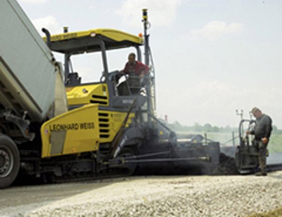
| The paving team of contractor Leonhard Weiss GmbH & Co. KG was highly satisfied with the system’s ease of operation and the achieved results. The team was particularly impressed by the high accuracy, with which NAVITRONIC® Plus controlled the paving process fully automatically. The staff could focus their attention on supervising the process of paving and supply of the paver with mix – the feeling was unfamiliar but yet reassuring. The surveyor on site, too, expressed his entire satisfaction with NAVITRONIC® Plus. Thanks to this smart technology, the tensioning of wires can be a thing of the past and constant, accurate checking of the final result is rendered possible. On the by-pass near St. Leon-Rot, the roadbase had been placed with such a high degree of accuracy that binder and wearing course, placed on top, could be paved all without automated grade and slope control. |
|
 |
Job Site Details
New construction of a section of the L546 bypass road near St. Leon-Rot, Germany
Length of Section
1.2km
Tight Bends
Radius no more than 400m
Transverse Slope
Up to 8%
Material (base course)
Bitumen-coated gravel (0/32)
Paving Details
Pave width: 7.6m to 7.8m
Layer thickness (base course): 12 - 16cm
Pave speed: 3.5m/min.
Equipment
SUPER 1900-2 with AB 600 Extending Screed in TV Version |
|
 |
Three Good Reasons for NAVITRONIC® Plus
NAVITRONIC® Plus combines control of grade and slope on the one hand, and control of the screed’s position and the paver’s direction of motion on the other, in one system. This makes NAVITRONIC® Plus a tool for real 3D machine control.
1. NAVITRONIC® Plus is a non-contacting 3D control system for road pavers.
2. NAVITRONIC® Plus fully integrates into VÖGELE NIVELTRONIC® Plus, and carries out:
– conventional control of grade and slope,
– fully automatic control of the screed’s position and the paver’s direction of motion.
3. NAVITRONIC® Plus comes with an “open interface” to connect the positioning system. Thanks to this interface, different makes from renowned manufacturers can be selected for combination with NAVITRONIC® Plus – no matter whether this system is an optical one with a laser-based total station and prism or a satellite-based one with GPS receiver and laser receiver (such as mmGPS from TopCon). |
|
 |
NAVITRONIC® Plus at a Glance
Technological Highlights
- Extends NIVELTRONIC® Plus into a real 3D control system (control of elevation and slope of the screed as well as control of the screed’s position and the paver’s direction of motion).
- Uses the route’s digital design data for accurate control of tractor unit and screed.
- Comes with an open interface to connect most varied 3D positioning systems offered by renowned manufacturers.
- Method of operation: comparison of the route’s design data with calculated actual data.
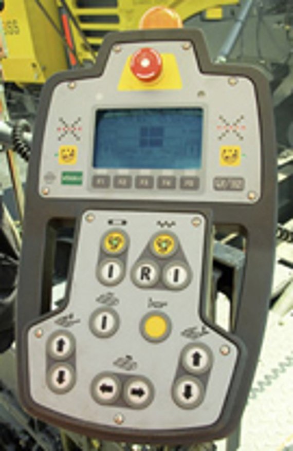
Components of NAVITRONIC® Plus
- 2 NAVITRONIC® Plus operating consoles for the screed (software included).
- Mast for mounting 3D receivers.
- Angle sensor for the mast.
- Sensors for picking up displacement of the screed’s extending units.
System Requirements for SUPER Pavers
- VÖGELE NIVELTRONIC® Plus.
- Other components, such as laser-based total station or GPS combined with a laser receiver
Công nghệ khác
“AutoSet Plus” is Quality Assurance at the Press of a Button
SprayJet versus Conventional Paving with Pre-Spraying of Emulsion